This link is exclusively for students and staff members within this organisation.

Unauthorised use will lead to account termination.

Previous

Who supported the Vietnam War?

Next

What were the dangers facing the Weimar Republic?

the historic environment

London’s East End and the Whitechapel murders

Whitechapel is a district in the East End of London. As the city’s population expanded in the nineteenth century, it became an overcrowded slum and a centre for crime. It was the location of the infamous Whitechapel murders in 1888. Rob Quinn explores this historic environment

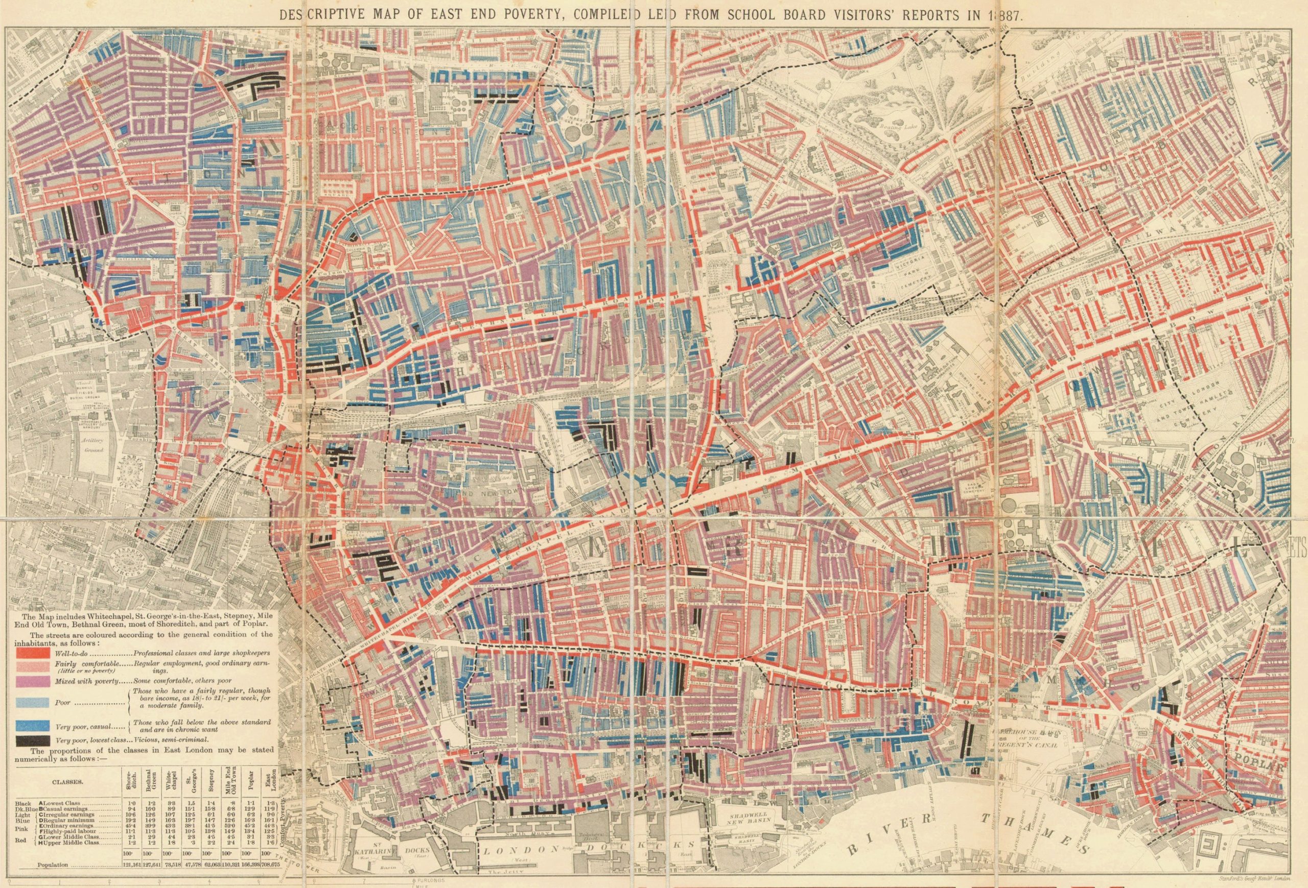
Source A Charles Booth’s poverty map of Whitechapel and Stepney in 1889. Dark blue areas are the poorest, dark red areas are the richest. Booth was a social reformer who showed that 35% of the population of this area of London lived below the poverty line

According to the 1881 census, 1 million people lived in London’s East End. Whitechapel was very densely populated. The Booth district, which included many of the locations of the Whitechapel murders, was the eighth most overcrowded in London with 256 people per acre. There were only 45 people per acre in London as a whole.

Rookeries were slum areas of overcrowded and filthy housing. The layout of streets and buildings made policing difficult. Criminals could hide from the police in the rookeries, and use the alleys and yards as places to watch for victims, hide after committing a crime, or to run criminal activities from. All the identified victims of Jack the Ripper lived in the heart of the rookery in Spitalfields.

Your organisation does not have access to this article.

Sign up today to give your students the edge they need to achieve their best grades with subject expertise

Subscribe

Previous

Who supported the Vietnam War?

Next

What were the dangers facing the Weimar Republic?

Related articles: