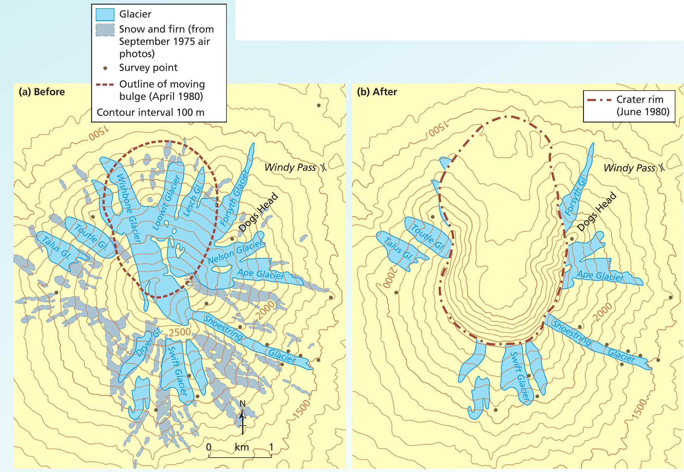
On 18 May 1980 Mt St Helens erupted with such violence that it dramatically reshaped the surrounding landscape. The eruption column reached 24,000 metres in less than 15 minutes and the ash cloud circled the Earth in 15 days. The eruption blast triggered the largest landslide on Earth in recorded history, removing 400 m from the top of the volcano as well as much of the northern flank. More than 2.5 km3 of debris were moved. Super-heated rocks and volcanic gases melted snow and glacier ice on the volcano, producing lahars that swept down the slopes of Mt St Helens, causing destruction and choking valleys with sediment.
The pre-eruption volcano was flanked by 11 named glaciers and its crater was filled with ice and snow. Figure 1 shows how most of the glacier ice was on the north-facing slopes. When the northern flank exploded, several of the largest glaciers were completely destroyed. All the ice and snow in the crater was melted or blasted skywards, eliminating the main accumulation zones for several glaciers. This left large areas of wasting ice on the surviving upper flanks of the volcano. About 70% of the ice volume was removed during the eruption. Only the Toutle and Talus glaciers survived relatively unscathed. Blocks of glacier ice were carried downslope in mudflows. Some 2 months after the main eruption, large blocks of glacier ice remained buried within the debris flow sediments in the North Fork Toutle River.
Your organisation does not have access to this article.
Sign up today to give your students the edge they need to achieve their best grades with subject expertise
Subscribe


