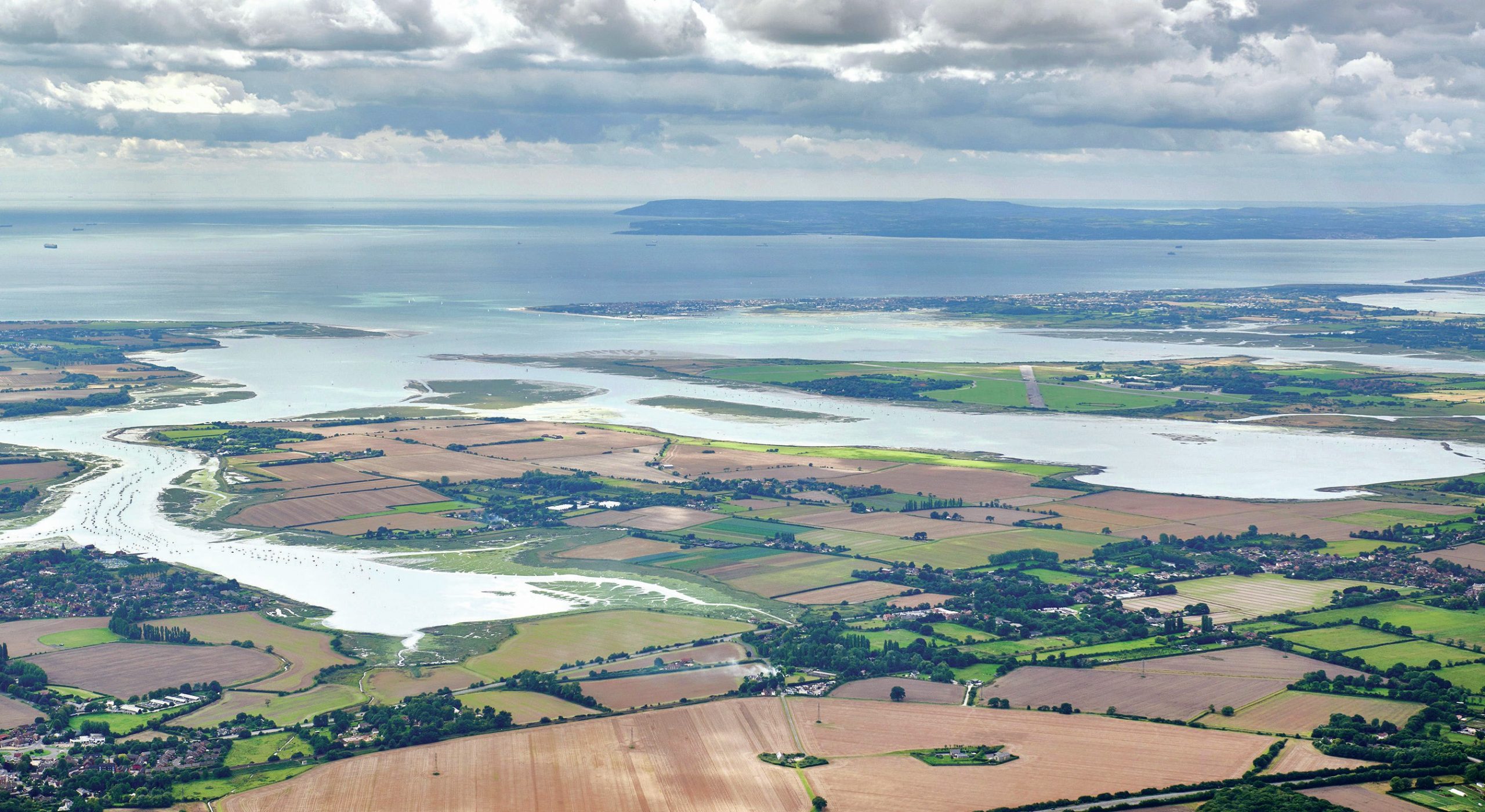
Chichester Harbour is an area of outstanding natural beauty (AONB) and a Site of Special Scientific Interest (SSSI). It consists of 31 km2of mudf lats and saltmarsh, sandbanks, spits and deep water channels (Figure 1). This natural harbour formed when part of an ancient river system was inundated by the post-glacial rise in sea level. During the Pleistocene, sea levels were around 120 m lower than today and tributaries of an ancient Solent River cut into the coastal plain. At the end of the Pleistocene (11,700 BP), sea level rose, f looding the river valleys, and effectively creating a ria coastline. By the Bronze Age (4200–2650 BP), the coastline was only 1 or 2 mlower than it is today and spits began to form at the harbour entrance, while mudf lats and saltmarsh became established in the basin.
The harbour, which is largely enclosed, can be viewed as a system, the main components of which are shown in Table 1.
Your organisation does not have access to this article.
Sign up today to give your students the edge they need to achieve their best grades with subject expertise
Subscribe


